Trail alerts

Closed Breakneck Ridge station is closed

What to do instead Get off at Cold Spring for the southern trail, Beacon for the northern.

What to do instead Full notice

No trains stop here. Closed April 2025, being rebuilt as part of the Fjord Trail.

active From Mon, Apr 21, 12:00 AM, until further notice Source: Metro-North

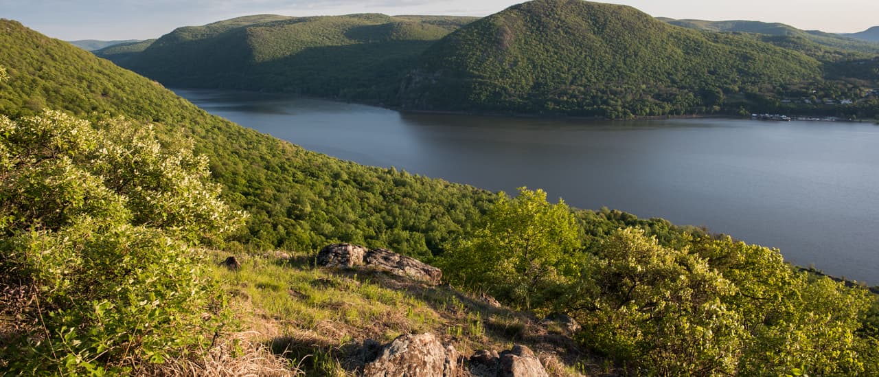
The Hudson from the open summit of Sugarloaf Mountain in early summer: lichen-crusted rock and dry grass in the foreground, flowering shrubs down the slope, and the river curving away between the green mass of Storm King and the wooded hills of both shores under a clear evening sky.

Explore

Explore

Between Cold Spring and Beacon the trail crosses marsh, forest, shoreline and a live railway. This is what is where.

The fjord from Sugarloaf Mountain, looking west toward Storm King. · Juliancolton, via Wikimedia Commons

The Fjord Trail corridor, Cold Spring to Beacon A schematic map of the Hudson Highlands Fjord Trail corridor between Cold Spring and Beacon, showing Main Trail. 7.8 miles end to end. The trail list at /map/ carries the same features as text. Hudson River Cold Spring Beacon
Indicative alignment — not survey data. Traced from the published FGEIS figures (January 2026) to about ±15–25 m. The trail is not built and the alignment is not final. Open the interactive map with Main Trail switched on · Read the same features as a list
Artist's rendering of the proposed Forest Zone: a boardwalk on slender posts runs through tall bare-trunked woodland, with large rope nets slung between the trees beside it. People are walking the boardwalk and lying and climbing in the nets above the forest floor.
Artist's rendering — not a photograph. Artist's rendering by SCAPE — the proposed Forest Zone climbing nets. Not built. · SCAPE

What it will look like

The environmental review published photo-simulations of the built trail from public viewpoints, each paired with the same view today.

Today
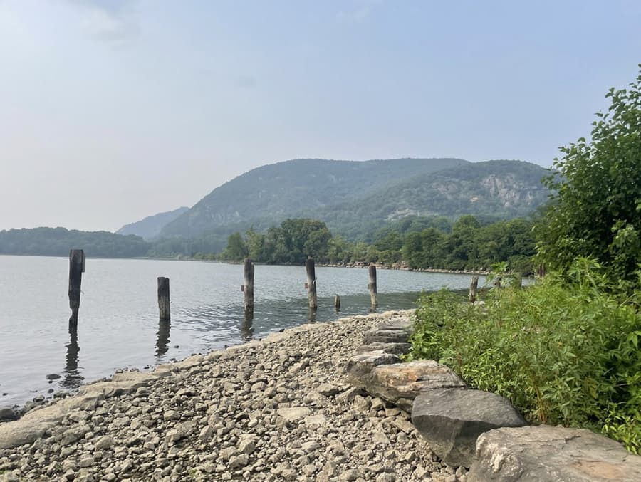
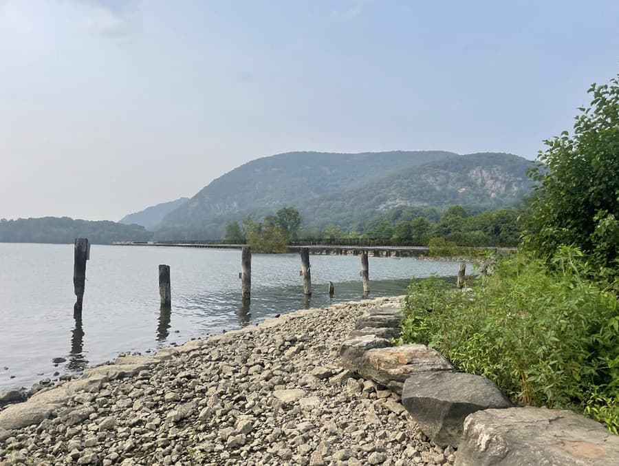
The view north from the shoreline at Dockside Park: a bank of rounded cobbles and boulders running away to the right, a row of weathered timber piles standing in the shallows, open water beyond them, and the wooded mountains upriver in summer haze.
Dockside Park, Cold Spring as it is today. FGEIS Figure IV.G-12 (dated 12.18.25), photo "a" — existing view. · Hudson Highlands Fjord Trail, Inc. / NYS OPRHP — Final GEIS, January 2026

With the trail built

The same view north from Dockside Park with the proposed Fjord Trail built. A long, low horizontal line now crosses the middle distance close to the waterline — the elevated trail deck and its fence running along the causeway — with the cobble bank, the old piles and the mountains otherwise unchanged.
Artist's rendering — not a photograph. Dockside Park, Cold Spring with the proposed trail built — an artist's rendering, not a photograph. FGEIS Figure IV.G-12 (dated 12.18.25), photo "b". · Hudson Highlands Fjord Trail, Inc. / NYS OPRHP — Final GEIS, January 2026

Today

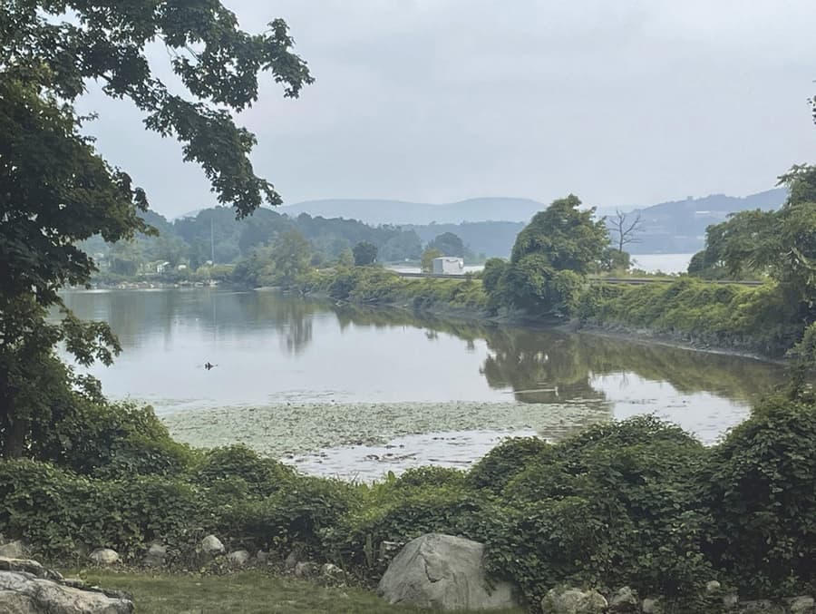
The view south-southwest from the lawn at Little Stony Point: a still inlet covered in lily pads, framed by leafy branches above and dense green scrub below, with the Metro-North causeway crossing the water in the middle distance and hazy hills behind.
Little Stony Point lawn as it is today. FGEIS Figure IV.G-10 (dated 12.18.25), photo "a" — existing view. · Hudson Highlands Fjord Trail, Inc. / NYS OPRHP — Final GEIS, January 2026

With the trail built

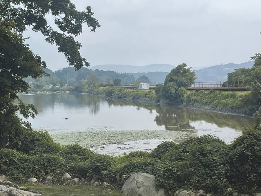
The same view south-southwest from the Little Stony Point lawn with the proposed Fjord Trail built. The trail deck and its fence appear along the top of the Metro-North causeway in the middle distance, reading as part of the existing railway structure; the inlet and the framing trees are unchanged.
Artist's rendering — not a photograph. Little Stony Point lawn with the proposed trail built — an artist's rendering, not a photograph. FGEIS Figure IV.G-10 (dated 12.18.25), photo "b". · Hudson Highlands Fjord Trail, Inc. / NYS OPRHP — Final GEIS, January 2026

Last reviewed